|
|
|
#1
|
||||
|
||||
|
Bermuda
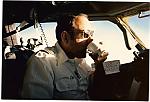
Back in the 1970's I did a few Bermuda trips as co-pilot on the B727. Back then we used the ADF off of ACK then there was a dead area both nav and comm until we could pick up something at Bermuda. As I recall we carried enough fuel for the trip plus enough to return to the main land in the event that we could not land be it wx or runway closure. Gosh how did we do it without Loran or GPS!
Guy, the old 72 driver.... 
|
|
#2
 05-15-10, 11:21 AM
|
||||
|
||||
|
For those concerned about this Bermuda trip -- 4 hours on a twin, in sunny weather, with GPS and 2 hours of fuel margin -- ask yourself if you'd rather be flying at night on a single over mountainous terrain, something which people do all the time.
Given the twin engines over water, a ditching is hugely unlikely, but if I have to ditch I like the stats that ditching has ~ 95% survival rate. Maybe it's because I'm constantly flying over water, but I'd much rather do the Bermuda trip than fly a single at night over the Rockies. Ernie
|
|
#3
05-15-10, 04:44 PM
|
|||
|
|||
|
Quote:
|
|
#4
05-15-10, 05:40 PM
|
||||
|
||||
|
Agreed, but I'd still prefer that to flying a single at night in mountainous terrain. Also, VHF comm isn't that bad. Aside from the number of airlines that overfly that part of the Atlantic to/from Europe (see one track in the image below), at 10,000 feet you should be in contact with aircraft flying over land at all times. Here's why: an aircraft out of JFK headed to Florida at 30,000 ft will have good VHF comm (line-of-sight) with you for 386 miles and then when you're 218 miles from Bermuda you will have the same good VHF comm (line-of-sight) with any aircraft flying over Bermuda at 3,000 ft.
Ernie
|
|
#5
05-15-10, 06:38 PM
|
|||
|
|||
|
"It takes due diligence to plan and execute a trip like this."
Absolutely, and I think that's what we're all saying...even if we're talking past each other a little. I think if he equips the airplane properly, plans the route carefully, briefs the family and/or passengers on what to expect and ditch procedures, goes feet wet from the east coast with a full load of fuel and good weather forecasts (and BDA NOTAMS checked!), it should be a walk in the park. I'd lay out a GPS track with :30 min user-defined waypoints, plus the calculated PNR on it. Prudence would also suggest maintaining a DR plot on a North Atlantic chart and comparing the fixes at each waypoint (you can tell I'm old school!). Recheck the wx and airport status just prior to the PNR and if all's well, press on. I would give fair warning that if you haven't done it before, it can be a bit of a 'lonely' somewhat intimidating feeling sitting out there with nothing around - a good reason for having something to do - like navigate! Bottom line: I'd be just as comfortable, probably more, trucking out to Bermuda at 10K as I am a hundred miles offshore at 700' on a survey track. Due diligence, and Bon Voyage- Ahab
|
|
#6
05-16-10, 02:06 PM
|
||||
|
||||
|
Be prepared for water survival, and you'll never need it. Not just a raft, but personal flotation devices and anti-exposure suits for everyone -- hypothermia is the #1 killer once in the water] , plus water desalination pumps x2, food, signaling devices (mirrors, radios, flares), fishing kits, etc.
|
|
#7
05-16-10, 03:30 PM
|
|||
|
|||
|
Quote:
|


 Hybrid Mode
